By Wayne Gates
The rain won’t seem to stop falling.
Brown County has had one of the wettest years on record so far in 2019. According to the National Weather Service, 4.64 inches of rain fell in the Russellville area between June 15 and June 17. The Ripley area saw 3.78 inches in the same time period and the Fayetteville area got 3.34 inches of rain in that time.
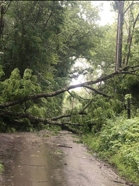
Brown County Emergency Management Agency Director Barb Davis said that the high winds that blew through the county on Monday, June 17 knocked a few trees and the rain resulted in some high water over roadways. She said a bigger problem is the cumulative effect of all the rain.
“Everything is really saturated, so any more rain is going to cause flash flooding,” Davis said.
“People are used to the water rising and receding quickly when we have thunderstorms, but right now the ground is saturated and the water has nowhere to go. It just makes it more likely that flash flooding is going to spread over the banks of the creeks and cross places where people haven’t seen it cross in a long time.”
Davis said that everyone should be diligent in case flash flooding happens in an unusual place.
“There is no way to predict exactly where that’s going to happen. It’s just going to be wherever that heavy part of the storm ends up and then how long it stays in that position.”
Davis said the common sense rules of driving near high water still apply.
“If you can’t see the roadway in front of you, don’t even attempt to cross the water. You need to remember the ‘Turn Around, Don’t Drown’ campaign. If you can’t see the road, it might mean the road might not be there under that water.”
And while the rain might leave some attractive and interesting puddles for kids who are playing outside, Davis said “It’s dangerous for children to be out in areas where flash flooding can occur. You never know when it’s going to happen and we don’t want to see a tragedy.”
Property owners can also take steps to try and reduce the impact of all the extra rain.
“Make sure that your ditches are clear so water can flow away from your property. When ditches get clogged up, the water can’t move beyond it and that’s where we get those places where the water crosses the roadway,” Davis said.
All the rain has not pushed the Ohio River into flood stage as of yet. Davis said the river is expected to crest 10 feet below flood stage soon at 38.1 feet. Flood stage is about 50 feet.
“That’s always subject to change because the height of the river is really predicated on the amount of rain they get east of us because the water moves west,” Davis said.
She is also concerned that some people who need to hear watches and warnings may not get them in a timely manner.
“Everyone is on their phones, or the internet or watching cable TV. Unless it’s something that rises to a wireless emergency alert, a lot of people don’t have other means to receive those warnings,” Davis said.
“The biggest thing people can do is make sure they have a weather alert app, or even better, a NOAA Weather Alert Radio to get information directly from the National Weather Service.”
NOAA Weather Alert Radios can be found online or at local retailers.


